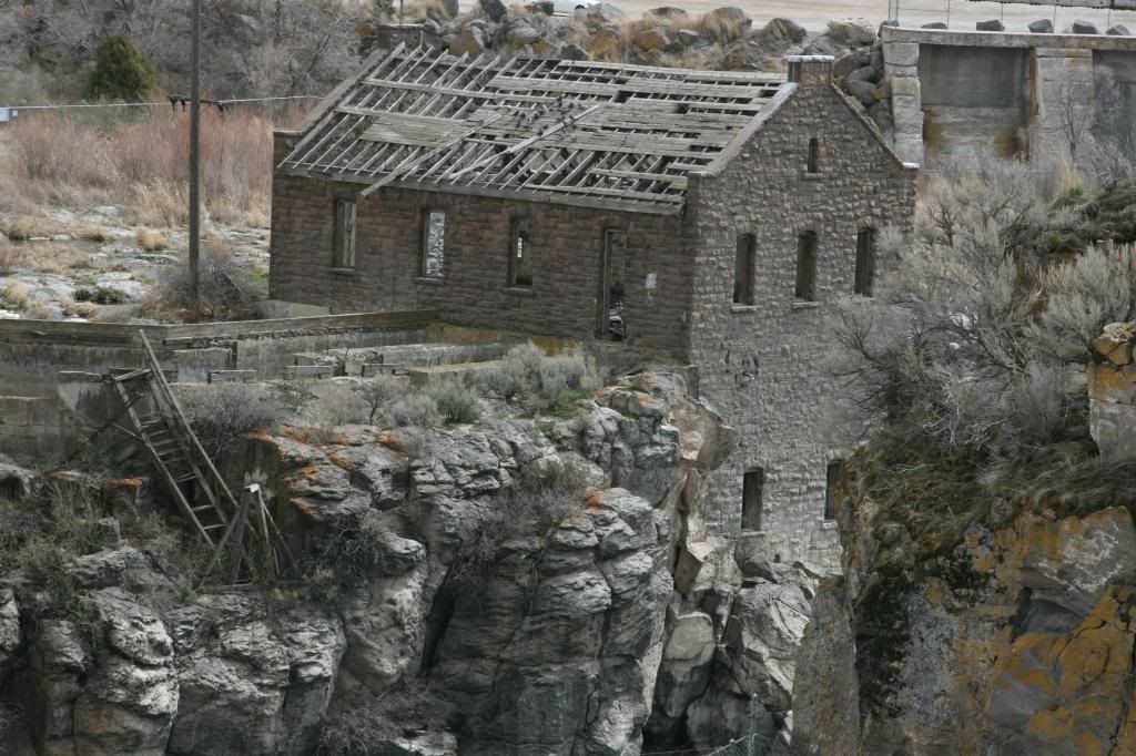
Collecting Impact Shatter Cones - Challis Idaho
Dec 17, 2014 9:49:13 GMT -5
RWA3006, bsky4463, and 3 more like this
Post by 1dave on Dec 17, 2014 9:49:13 GMT -5
In my reading of This Paper I've found an area some of you may wish to explore.
This is a busy little area! The Beaverhead, Yellowstone, The Stillwater Complex - Chromium and Platinum group Elements . . .
Somewhere between 1,000 and 500 million years ago, an asteroid/comet slammed into the area between Montana and Idaho, creating a crater about 100 km in diameter known as the Beaverhead.
(Figure 2 is just a black and white photo of a shatter cone.)
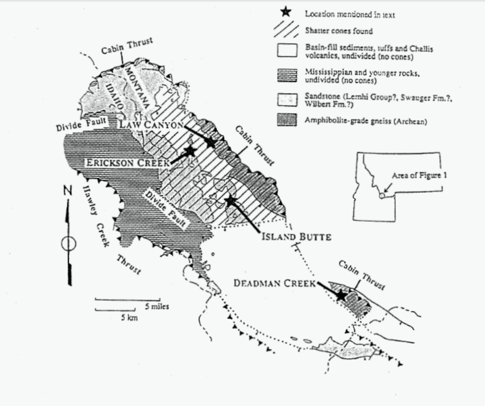
Figure 1
I am curious about the "10 meter quartzite fragments suspended in sand," mentioned below, and hope someone shares photos.
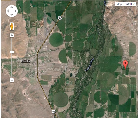
Red Marker points to Leaton Gulch.
This is a busy little area! The Beaverhead, Yellowstone, The Stillwater Complex - Chromium and Platinum group Elements . . .
Somewhere between 1,000 and 500 million years ago, an asteroid/comet slammed into the area between Montana and Idaho, creating a crater about 100 km in diameter known as the Beaverhead.
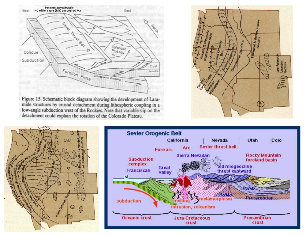
The Beaverhead impact structure in SW Montana and Idaho is an allochthonous fragment
of a large impact structure (- 100 km diameter) that was transported some distance eastward
during the Cretaceous Sevier orogeny . . .
With an extensive and diverse Precambrian and Paleozoic stratigraphy, complicated by intense Cretaceous tectonism and Tertiary extension, the geology of the Challis area is known to be unusually complicated (Hobbs and others, 1990, 1991).
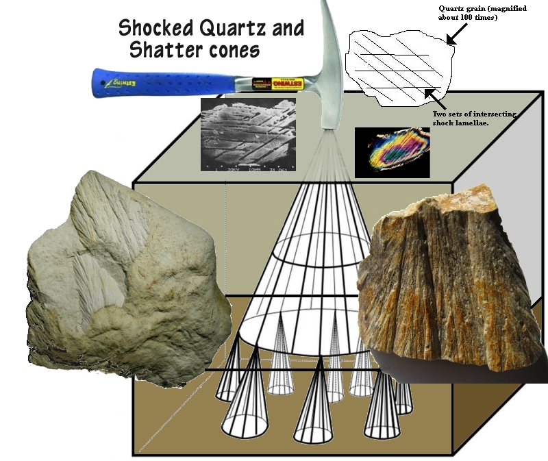
SHATTER CONES
Shatter cones are considered to be diagnostic indicators of meteorite impact and have been replicated in nuclear and high explosive cratering and laboratory impact experiments (Sharpton and Grieve, 1990). Shatter cones are conical fracture patterns developed during the passage of a shock wave through rock (Dietz, 1960). The surface of the cones has distinctive striations which radiate from small parasitic horsetail-like half cones on the face of larger cones (Figure 1). The diverging pattern of the striations is distinct from the parallel grooves formed on slickensides. After making appropriate corrections for post-impact deformation, shatter cones have been shown to point toward "ground zero" in several impact structures (e.g. Vredefort, South Africa; (Manton, 1965), Wells Creek, Tennessee; (Steams and others, 1968), and Gosses Bluff, Australia; (Milton and others, 1972)). At the Beaverhead structure, shatter cones occur over an area > 200 km2 and are extremely well developed in the area north of Island Butte (Figure 2). They occur solely in sandstones and underlying granitic basement gneiss. There is a non-random pattern of shatter cone orientations that may be structurally significant. In the area north of Island Butte the shatter cones point steeply upward and generally northward. In the area of Erickson Creek the shatter cones point shallowly to the east and throughout basement gneisses the shatter cones point southward at a variety of angles.
In the area of Erickson Creek (Figure 2), the relationship between the shatter cones and sandstone bedding suggests that, at least in this area, much of the structural deformation found in the sandstones predates the impact. The attitude of sandstone bedding is variable, with many beds steeply dipping or overturned. However, the pointing direction of the shatter cones throughout this area is consistently shallow and to the east. This "negative fold test" using shatter cones suggests that deformation prior to the impact was substantial. However in the area of Island Butte the shatter cones have a more consistent relationship to bedding suggesting little deformation prior to impact.
The lack of any circular symmetry to the shatter cone orientations may suggest that they represent only a small segment of the original distribution of cones, and that much of the present deformation in the sandstones is older than the impact event. As shatter cones are formed only in the central third of large impact craters, it is the present truncated distribution of cones which suggests an original crater diameter of at least 75- 100 km in diameter.
(Figure 2 is just a black and white photo of a shatter cone.)
Figure 1
I am curious about the "10 meter quartzite fragments suspended in sand," mentioned below, and hope someone shares photos.
Suspect deposits in the Challis area
With an extensive and diverse Precambrian and Paleozoic stratigraphy, complicated by
intense Cretaceous tectonism and Tertiary extension, the geology of the Challis area is known to be unusually complicated (Hobbs and others, 1990, 1991). Literature searches followed by
reconnaissance field investigations have yielded two intriguing features which might be related
to the impact event.
Jacob (1990) reports an unexpected "silicic lithic tuff' encountered in a borehole beneath
the lower Paleozoic sequence in the Bayhorse anticline. The hole, 3749 feet deep, was drilled
approximately five miles west of Challis, Idaho (Figure 3). This unit was originally interpreted
as a diamictite, but petrographic study by B. F. Leonard (written communication to S. W. Hobbs,
196?) "disclosed the volcanic nature of the matrix components," Despite these encouraging
hints, study of the same samples and thin sections (kindly made available by S. W. Hobbs) has
revealed no compelling evidence of shock deformation or melting.
An intraformational breccia zone, up to 20m thick, present in the Leaton Gulch area (late
Precambrian?) (McIntyre and Hobbs, 1987) is another intriguing occurrence (Figure 3). This
monolithologic breccia, consisting of angular to subrounded quartzite fragments up to 10 meters in size, suspended in a silicified sand matrix, is well exposed in and around the road up Leaton Gulch in the Pahsimeroi mountains east of Challis. Underlying units are intact. Reconnaissance field examination has confirmed that this breccia is intraformational, but it is not yet certain that there is only one layer. Thin section examination has revealed considerable evidence of strain including undulatory extinction and planar fractures in quartz, but again, nothing diagnostic of shock deformation. Whatever the origin of this breccia, the occurrence of quartzite breccia intraformational in quartzite is distinctly anomalous and merits further study.
Red Marker points to Leaton Gulch.