Post by 1dave on Feb 28, 2014 16:52:41 GMT -5
An extension of Geology for Rockhounds.
Knowing Where and When in Time to look is a great Luck Enhancer.
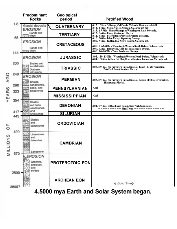
You are welcome to download and print this 8 1/2" X 11" chart.
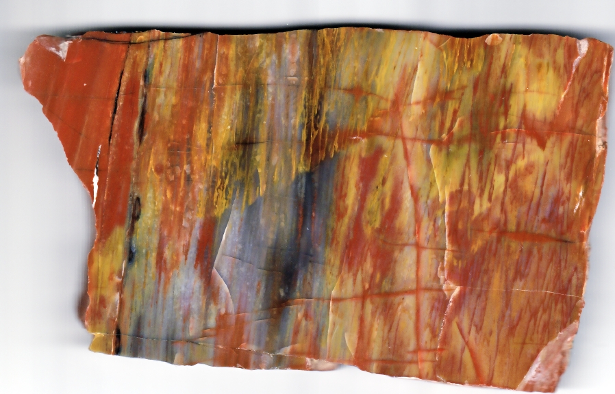
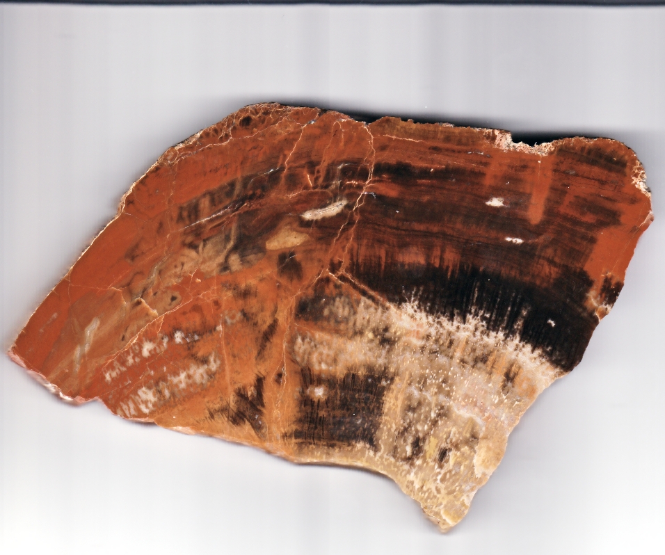
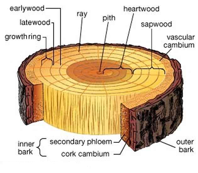
Plants have come up with all kinds of ingenious structures to support and supply nutrients to leaves, and that affects how wood petrifies.
Anything that dies and remains on the surface of the earth disintegrates into the environment. To survive in any meaningful form it must be buried below the bio-active layer of soil or water.
How it petrifies depends on local circulation properties, humidity, temperature, how soon it is buried, and the elements and pressure around it during the process.
The first plants appeared on land about five hundred million years ago but the first we would identify as trees, Wattieza and Archaeopteris, did not appear until 385 - 370 Mya in the Devonian period when the world looked a little different.
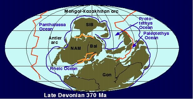
NAM = the North American Continent.
Even way back then eat or be eaten was the law of survival.
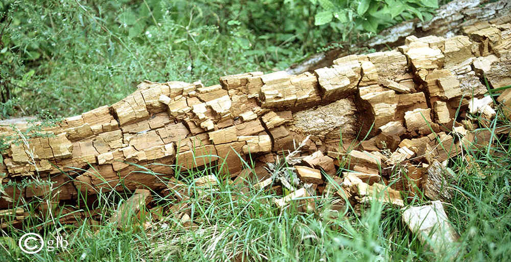
Dying and moisture brought acid, bacteria, fungi, and eventually insects to devour their corpses.
Sunshine and heat brought drying, converting them into driftwood, lightning and fire.
Ashes to ashes, dust to dust.
Usually no petrification takes place.
In the rare instances when it does happen, as verified by over 200 Mindat photos from all over the world, - it is usually a small area, as when a few dozen or hundred trees are buried in a brief volcanic ash fall, landslide or
#1. 380 Ma - a sand storm as apparently buried some early trees standing upright in New York about 380 million years ago.
In unusual circumstances huge ash falls or deep burials in water or soil where no oxygen is present, large areas can be covered with fossil remains, as happened with the Cambrian trilobites.
Petrified wood can preserve the original cells down to the microscopic level. Structures such as tree rings and the various tissues are often observed. Sometimes the outer shell is perfectly preserved, but the inside is solid agate or opal showing no details.
#2. 251 Ma - Shinarump
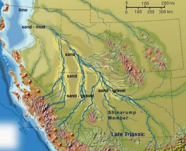
Publication:
Gilbert, G.K., 1875, Report upon the geology of portions of Nevada, Utah, California, and Arizona, Chapter 6, IN Report on the geographical and geological explorations and surveys west of the One Hundredth Meridian (Wheeler): U.S. Geological and Geographical Survey, Publication of the Wheeler Survey, v. 3, p. 17-187.

The Western Edge of the Colorado Plateau towers over Cedar City Utah, revealing most of the geology of the area.
The Shinarump, prominent around St. George, was eroded away in Cedar City.
230 million years ago The Atlantic ocean was just beginning to open up. Midwestern Nevada was the west coast.
The Sonomia Island arc began colliding with the continent initiating the Sonoma orogeny, an extended period of mountain building and adding land to western North America.
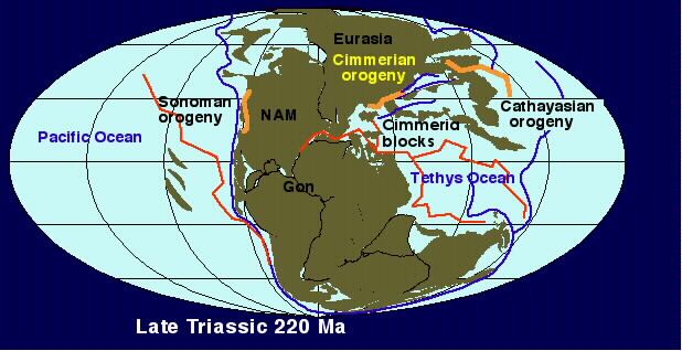
The Atlantic Ocean is just barely starting to open up.
#3. 225 Ma - Chinle of which the Petrified Forest National Park in Arizona is just a tiny part.

Check out your local Geology maps.
Here, the Petrified Forest Member of the Chinle is plainly visible just to the east and above the city.

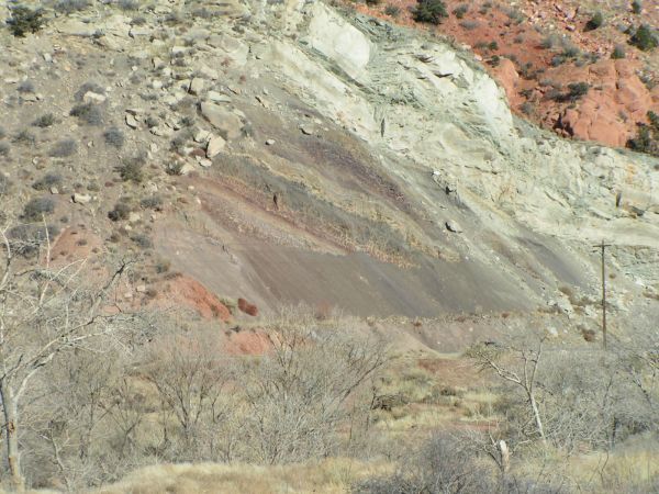
An excellent study of Chinle time was prepared by Russell F. Dubiel.
The "Shinarump Valley" now under the Chinle, covered existing Nevada, Utah, the southwestern corner of Colorado, Arizona, New Mexico, and the panhandle of Texas.
Offshore to the southwest volcanoes where California would be born were constantly showering the area with ash-fall after ash-fall, laying down thick ash layers now known as the Painted Desert, fertile Chinle soil where big trees could grow.
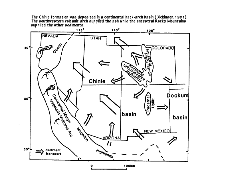
Then 225 Million years ago something unusual happened in the area now known as the southwestern United States to produce the vast area known as the Petrified Forest Member of the Chinle (AKA "The Painted Desert") Formation and Dockum Formation as it was named in Texas. It is inter-continental, stretching from Nevada (the west coast back then) to western Texas.
That is an area roughly 1,000 miles long by 500 miles wide. 500,000 Square miles!
And then we find that whole area covered with 225 million year old petrified wood. What happened?
At that time the Atlantic ocean was opening up, pushing North America westward. I suspect a collapse of the western seafloor generated a huge tsunami.
A firsthand report from 1890 states:
Re-Quote:
What was the home source of the conglomerate and white quartz found scattered across central Texas?
It had to be an area northwest of Dockum. Where?
What force scattered it?
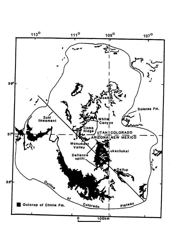
Here is what is left visible of the Petrified Forest Member of the Chinle Formation.
What buried all those huge trees from Nevada to Texas AND splayed rocks on to the east???
Meandering streams? (the usual answer) I don't find that scenario credible.
Asteroid impact? Nope, no extraterrestrial material, no tektites. Volcanic ash? No, none present in significant amounts. Landslide? No. Sandstorm? No.
Tsunami from a powerful earthquake in the Pacific . . . ?
Now that has promise! We know Pacific Island arcs were crashing ashore as the Atlantic ocean was still opening up, pushing North America westward. I suspect a collapse of the western seafloor generated another huge tsunami. Re-triggering another under sea earthquakes isn't much of a stretch. Huge wave rushing ashore churning up everything in its path, tumbling huge trees and ripping off their branches before burying them, channeled up the Shinarump valley by high ground to the northeast and southwest, losing strength and fanning out on reaching Texas, scattering ever smaller conglomerate chunks and white quartz pebbles . . . I like it!
Petrified driftwood is found sporadically throughout the Navajo sandstone. Life existed around it.
#4. 150 Ma - Yellow Cat Flat, just north of Moab Utah.


The Morrison Formation of the Jurassic period is best known for dinosaur fossils, but scattered among the bones are even more remains of the trees the vegetarians fed upon. Some of the most noteworthy specimens of petrified wood come from Yellow Cat Flat, famous for its rich red color and orange to yellow highlights that result from the presence of iron and other metal compounds.

Visitors to the area should be advised that Yellow Cat Flat and the surrounding area is extremely desolate and dry (the ground water is contaminated with uranium and arsenic). There’s no food, bathrooms, accommodation or cell phone service.
#5. 120-130Ma - Western South Dakota.
www3.northern.edu/natsource/earth/Petrif1.htm
#6. 80-100Ma - Texas - Louisiana Petrified Palm Wood
www.intersurf.com/~chalcedony/Palm.html
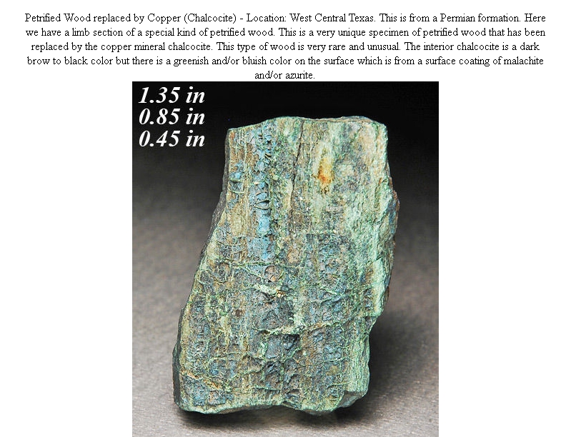
I purchased this on Ebay, Wood from Central Texas petrified with copper - azurite and malachite.
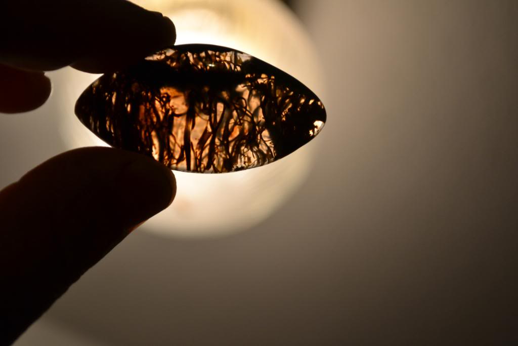
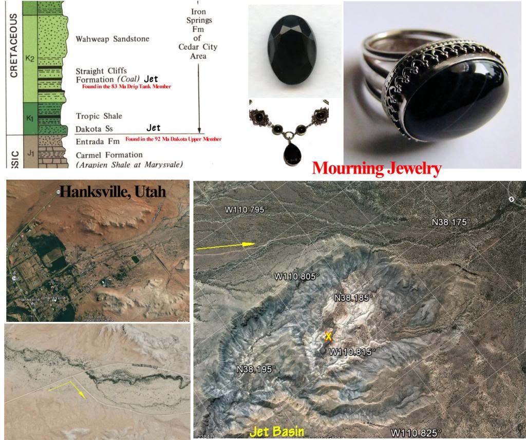
#7. 92 Ma - JET - Petrified (Coalified) Wood. “Jet is a product of high pressure decomposition of wood from millions of years ago, commonly the wood of trees of the Araucariaceae family. Jet is found in two forms, hard and soft. Hard jet is the result of the carbon compression and salt water; soft jet is the result of the carbon compression and fresh water.”
During the 15th and 16th century it became fashionable to give Mourning Jewelry of black and white stones to relatives of the deceased
Mourning jewelry made of Jet (182 million year old early Jurassic, from Whitby, North Yorkshire, England) reached its height of popularity in England after the death of Prince Albert in December 1861. Queen Victoria went into deep mourning, which was imitated by her subjects when faced with their own bereavements.
Jet jewelry made a comeback with all the flu deaths and the first World War in 1918, and was adopted by the Flappers of the 1920's.
In 1916-18 Tiffany & Co of NYC heard of Jet being discovered near Hanksville Utah and purchased most of the entire production until supply finally overran demand in 1926.
In Utah it is found in two Cretaceous Rock Formations, The Dakota Sandstone and the Straight Cliffs.
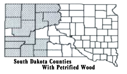
#8. 65-144 Ma - Western South Dakota.
www3.northern.edu/natsource/earth/Petrif1.htm
#9. 55 Ma - Western North Dakota - Theodore Roosevelt National Park
www.dmr.nd.gov/ndgs/ndnotes/ndn12.htm
www.statesymbolsusa.org/North_Dakota/fossil-petrifed-wood.html
#10. 50 Ma - Blue Forest of Eden Valley, Wyoming.
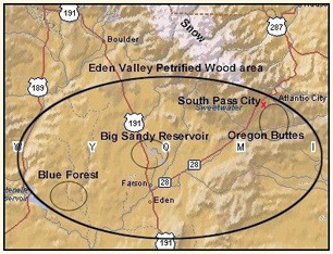
webecoist.momtastic.com/2010/09/14/hard-woods-10-amazing-petrified-forests/
#11. 48Ma - Yellowtone Petrified Forests
petrifiedwoodmuseum.org/SpecimenRidge.htm
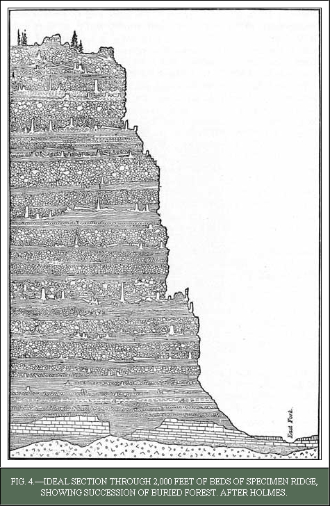
“In Yellowstone remnants of 27 fossil forests are embedded within 366m of sediment (Kenrick & Davis, 2004, p. 61). Clusters of fossilized trees, exposed at Specimen Ridge, represent a succession of over a dozen of these forest remnants (Yuretich, 1984, p. 159). Many trees are preserved in their original growth position (Fritz, 1980, p. 313, Retallack, 1981, p. 52, Yuretich, 1984, p. 161). The hike to Specimen Ridge begins at a pullout on the south side of the road 5.3 miles east of Tower Junction in the Lamar Valley. The 1.5-mile hike to the trees has a gain of 1,200 feet. The round trip is 3 miles and takes 2 to 3 hours. The hike is strenuous.
The fossil plant deposits were formed during the Eocene by periodic volcanic activity some 48 million years ago as indicated by radiometric dating and biostratigraphic correlation (Fritz, 1984, p. 638). During the Eocene two northwest trending subparallel volcanic chains formed the Western and Eastern Absaroka Belts. The Absaroka eruptive centers were 25 to 60 km apart with a narrow intermontane basin in-between them. The Larmar River Formation petrified wood deposits are found between these two volcanic chains (Fritz, 1980, p. 312).
#12. 36Ma - Petrified Forest in Flora, Mississippi.
#13. 15.5Ma - Ginkgo/Wanapum State Park in Washington State.
#14. 14 Ma - Virgin Valley, Nevada.
pubs.usgs.gov/circ/0142/report.pdf
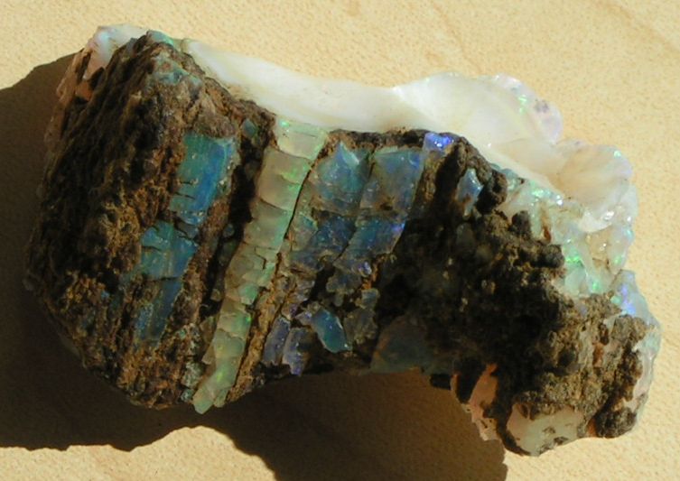
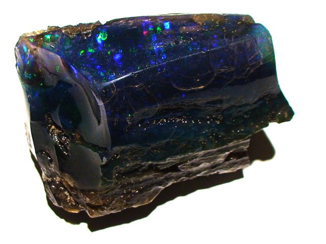
Virgin Valley opals are predominately limb casts, but include opalized branches, bark, roots, pine cones, and seeds embedded in clay beds. Most limbs come from an ancient tree species called Cryptomeria, a relative of the Sequoia. Opalized bones and teeth of vertebrate animals have also been found, including teeth from the now-extinct three-toed horse (Miohippus).
Virgin Valley opals are found in layers of clay that were formed when volcanic ash filled an ancient lake about 14 million years ago, along with the surrounding forests which were also choked with the ash.
#15. 3Ma - Petrified Forest in California.
gocalifornia.about.com/cs/napasonoma/a/canapapetrified.htm
Knowing Where and When in Time to look is a great Luck Enhancer.
You are welcome to download and print this 8 1/2" X 11" chart.


Plants have come up with all kinds of ingenious structures to support and supply nutrients to leaves, and that affects how wood petrifies.
Anything that dies and remains on the surface of the earth disintegrates into the environment. To survive in any meaningful form it must be buried below the bio-active layer of soil or water.
How it petrifies depends on local circulation properties, humidity, temperature, how soon it is buried, and the elements and pressure around it during the process.
The first plants appeared on land about five hundred million years ago but the first we would identify as trees, Wattieza and Archaeopteris, did not appear until 385 - 370 Mya in the Devonian period when the world looked a little different.

NAM = the North American Continent.
Even way back then eat or be eaten was the law of survival.
Dying and moisture brought acid, bacteria, fungi, and eventually insects to devour their corpses.
Sunshine and heat brought drying, converting them into driftwood, lightning and fire.
Ashes to ashes, dust to dust.
Usually no petrification takes place.
In the rare instances when it does happen, as verified by over 200 Mindat photos from all over the world, - it is usually a small area, as when a few dozen or hundred trees are buried in a brief volcanic ash fall, landslide or
#1. 380 Ma - a sand storm as apparently buried some early trees standing upright in New York about 380 million years ago.
In unusual circumstances huge ash falls or deep burials in water or soil where no oxygen is present, large areas can be covered with fossil remains, as happened with the Cambrian trilobites.
Petrified wood can preserve the original cells down to the microscopic level. Structures such as tree rings and the various tissues are often observed. Sometimes the outer shell is perfectly preserved, but the inside is solid agate or opal showing no details.
#2. 251 Ma - Shinarump
Publication:
Gilbert, G.K., 1875, Report upon the geology of portions of Nevada, Utah, California, and Arizona, Chapter 6, IN Report on the geographical and geological explorations and surveys west of the One Hundredth Meridian (Wheeler): U.S. Geological and Geographical Survey, Publication of the Wheeler Survey, v. 3, p. 17-187.
Summary:
First used as a name applied to a 50-ft thick yellow conglomerate with petrified wood above 200 ft of chocolate sandstone and shale [Moenkopi Formation] and below variegated gypsiferous clay [Chinle Formation]. Source of name not stated. [Shinarump cliffs and Shinarump mesa which are in southern Kane Co, UT in the Plateau sedimentary province, noted on p. 84.] No type locality designated. Section measured at north fork of Virgin River from vicinity of Mountain Lakelet to Rockville, Washington Co, UT. Shinarump also identified by E. E. Powell, Chapter 8, p. 247-248, 270-273, 284, in Washington Co, UT at Pine Valley Mountains, near Paria, near Toquerville, and in NV in the Virgin Range in the Great Basin province. Assigned to the Trias.
Source: GNU records (USGS DDS-6; Denver GNULEX).
The lowermost member of the Chinle, the Shinarump, consists of a white, gray, and brown conglomerate made of coarse sandstone, and thin lenses of sandy mudstone, along with plentiful petrified wood. The Shinarump was laid down in braided streams that flowed through valleys eroded into the underlying Moenkopi Formation.[8] This member of the Chinle forms prominent cliffs with thickness up to 200 feet (60 m), and its name comes from a Native American word meaning "wolf's rump" (a reference to the way this member erodes into gray, rounded hills)

The Western Edge of the Colorado Plateau towers over Cedar City Utah, revealing most of the geology of the area.
The Shinarump, prominent around St. George, was eroded away in Cedar City.
230 million years ago The Atlantic ocean was just beginning to open up. Midwestern Nevada was the west coast.
The Sonomia Island arc began colliding with the continent initiating the Sonoma orogeny, an extended period of mountain building and adding land to western North America.

The Atlantic Ocean is just barely starting to open up.
#3. 225 Ma - Chinle of which the Petrified Forest National Park in Arizona is just a tiny part.

Check out your local Geology maps.
Here, the Petrified Forest Member of the Chinle is plainly visible just to the east and above the city.

An excellent study of Chinle time was prepared by Russell F. Dubiel.
The "Shinarump Valley" now under the Chinle, covered existing Nevada, Utah, the southwestern corner of Colorado, Arizona, New Mexico, and the panhandle of Texas.
Offshore to the southwest volcanoes where California would be born were constantly showering the area with ash-fall after ash-fall, laying down thick ash layers now known as the Painted Desert, fertile Chinle soil where big trees could grow.

Then 225 Million years ago something unusual happened in the area now known as the southwestern United States to produce the vast area known as the Petrified Forest Member of the Chinle (AKA "The Painted Desert") Formation and Dockum Formation as it was named in Texas. It is inter-continental, stretching from Nevada (the west coast back then) to western Texas.
That is an area roughly 1,000 miles long by 500 miles wide. 500,000 Square miles!
And then we find that whole area covered with 225 million year old petrified wood. What happened?
At that time the Atlantic ocean was opening up, pushing North America westward. I suspect a collapse of the western seafloor generated a huge tsunami.
A firsthand report from 1890 states:
A few miles before reaching Dockum, situated in the western edge of Dickens County, I came upon a bed of conglomerate sandstone* and red clay, resting unconformably upon the clays and sandstones of the upper Permian, entirely unlike anything I have heretofore seen in Texas. This formation lies along the foot of the Staked Plains in a narrow belt. Because of its extensive occurrence in the vicinity of Dockum, I gave the formation the name of Dockum Beds, but will not for the present attempt to determine their correlation. I have found everywhere on the beds of the Permian belt pieces of conglomerate and large pebbles of white quartz that did not belong to the Trinity sands of the Cretaceous which were supposed to overlie the Permian to the westward, and it is a matter of interest to know where this drift came from. The fragments of conglomerate increased in size as we traveled westward until we came upon the beds of that material in the vicinity of Dockum, and the question was solved as to the origin of the fragments of conglomerate and the quartz pebbles.
In the conglomerate are many silicified trunks of trees, some of them of great length. In the red clay above the conglomerate are fossil remains of large reptiles, whose species I was unable to determine in the field. In the upper sandstone were many casts of a Ohio that I have provisionally called Onto documensis. In most places that fossil occurs only as casts, and in one place only did I find specimens of both valves, and they were so badly incrusted with carbonate of lime that the peculiar markings of the shell could not be seen. The sandstone was everywhere full of scales of mica, some of the scales being one-sixteenth of an inch square. The whole thickness of this formation in this vicinity is about 150 feet. These beds extend under the Staked Plains. I traced them up Blanco Canyon to the falls of White River, where they pass out of sight under the beds of the overlying strata.
There are a great many springs of clear pure water flowing from these beds, and wherever the formation has been penetrated by wells, an abundance of good water has been obtained..
-Cummins, W.F., 1890, The Permian of Texas and its overlying beds
Re-Quote:
"I have found everywhere on the beds of the Permian belt pieces of conglomerate and large pebbles of white quartz that did not belong to the Trinity sands of the Cretaceous which were supposed to overlie the Permian to the westward, and it is a matter of interest to know where this drift came from. The fragments of conglomerate increased in size as we traveled westward until we came upon the beds of that material in the vicinity of Dockum . . . many silicified trunks of trees, some of them of great length."
What was the home source of the conglomerate and white quartz found scattered across central Texas?
It had to be an area northwest of Dockum. Where?
What force scattered it?
Here is what is left visible of the Petrified Forest Member of the Chinle Formation.

What buried all those huge trees from Nevada to Texas AND splayed rocks on to the east???
Meandering streams? (the usual answer) I don't find that scenario credible.
Asteroid impact? Nope, no extraterrestrial material, no tektites. Volcanic ash? No, none present in significant amounts. Landslide? No. Sandstorm? No.
Tsunami from a powerful earthquake in the Pacific . . . ?
Now that has promise! We know Pacific Island arcs were crashing ashore as the Atlantic ocean was still opening up, pushing North America westward. I suspect a collapse of the western seafloor generated another huge tsunami. Re-triggering another under sea earthquakes isn't much of a stretch. Huge wave rushing ashore churning up everything in its path, tumbling huge trees and ripping off their branches before burying them, channeled up the Shinarump valley by high ground to the northeast and southwest, losing strength and fanning out on reaching Texas, scattering ever smaller conglomerate chunks and white quartz pebbles . . . I like it!
Petrified driftwood is found sporadically throughout the Navajo sandstone. Life existed around it.
#4. 150 Ma - Yellow Cat Flat, just north of Moab Utah.


The Morrison Formation of the Jurassic period is best known for dinosaur fossils, but scattered among the bones are even more remains of the trees the vegetarians fed upon. Some of the most noteworthy specimens of petrified wood come from Yellow Cat Flat, famous for its rich red color and orange to yellow highlights that result from the presence of iron and other metal compounds.

Visitors to the area should be advised that Yellow Cat Flat and the surrounding area is extremely desolate and dry (the ground water is contaminated with uranium and arsenic). There’s no food, bathrooms, accommodation or cell phone service.
#5. 120-130Ma - Western South Dakota.
www3.northern.edu/natsource/earth/Petrif1.htm
The early Cretaceous Lakota Sandstone deposits, which are found on the outside edge of the Black Hills, probably contain the oldest petrified wood specimens in the state. These fossils formed between 120 and 130 million years ago. Species in these deposits include bald or white cypress, several species of palm, and several species of cycadeoids .
#6. 80-100Ma - Texas - Louisiana Petrified Palm Wood
www.intersurf.com/~chalcedony/Palm.html
I purchased this on Ebay, Wood from Central Texas petrified with copper - azurite and malachite.
#7. 92 Ma - JET - Petrified (Coalified) Wood. “Jet is a product of high pressure decomposition of wood from millions of years ago, commonly the wood of trees of the Araucariaceae family. Jet is found in two forms, hard and soft. Hard jet is the result of the carbon compression and salt water; soft jet is the result of the carbon compression and fresh water.”
During the 15th and 16th century it became fashionable to give Mourning Jewelry of black and white stones to relatives of the deceased
Mourning jewelry made of Jet (182 million year old early Jurassic, from Whitby, North Yorkshire, England) reached its height of popularity in England after the death of Prince Albert in December 1861. Queen Victoria went into deep mourning, which was imitated by her subjects when faced with their own bereavements.
Jet jewelry made a comeback with all the flu deaths and the first World War in 1918, and was adopted by the Flappers of the 1920's.
In 1916-18 Tiffany & Co of NYC heard of Jet being discovered near Hanksville Utah and purchased most of the entire production until supply finally overran demand in 1926.
In Utah it is found in two Cretaceous Rock Formations, The Dakota Sandstone and the Straight Cliffs.
pubs.usgs.gov/mf/1985/1756a/report.pdf
“Jet, a gemstone variety of lignite coal, occurs near the top of the Cretaceous Dakota Sandstone
approximately 1/2 mi north of the study area in the SE1/4 sec. 22, T. 30 S., R. 10 E. (Gese, 1984b). Jet was produced from this area from 1919 to 1925, however, no jet is known to occur within the study area.
Geology and Mineral Resources of Garfield County, Utah 1957 - Page 159
“Jet Coal. Small amounts of jet coal are located ln the Straight Cliffs Formation which outcrops in the Right Hand Fork of Collet Canyon (Carcass Canyon quadrangle) on Smoky Mountain Road between the towns of Big Water on US 89 and Escalante on Utah 12, west of the Kaiparowits Plateau. The jet coal is found as coalified branches or pieces of branches completely enclosed in clay beds.
The best jet locality in the state of Utah is just north of the Henry Mountains in an area known as Jet Basin (Wayne County). The Jet Basin coal is found in a similar host as that in Garfield County, but the branches are flattened. Continued digging could expose additional logs or branches of this material. Jet coal is a shiny material that breaks conchoidally with a smooth surface. It can be polished into black jewelry. Jet has not been fashionable for many years.
More: pubs.usgs.gov/bul/1274j/report.pdf
From Utah 24 in Hanksville, turn south on 100E which continues as Sawmill Road as it leaves town. Continue south for about 6 miles. Turn right just before crossing Dry Wash (signed "Dugout Bench, Birch Creek"). Continue 4.2 miles to another junction. turn left and continue for 5.3 miles. Park close to the lower end of the knoll on the right side of the road. Find a trail down into the basin and walk about 0.5 miles to begin looking for jet. The jet occurs below a 6 inch coal bed.
#8. 65-144 Ma - Western South Dakota.
www3.northern.edu/natsource/earth/Petrif1.htm
#9. 55 Ma - Western North Dakota - Theodore Roosevelt National Park
www.dmr.nd.gov/ndgs/ndnotes/ndn12.htm
www.statesymbolsusa.org/North_Dakota/fossil-petrifed-wood.html
The badlands of western North Dakota have a lot of good to show you, if you’re interested in petrified wood. Dating from the Paleocene Era (about 55 million years ago, after the dinosaurs went extinct), petrified wood can be found in scattered chunks, eroded logs and truncated trunks that still stand upright.
#10. 50 Ma - Blue Forest of Eden Valley, Wyoming.
webecoist.momtastic.com/2010/09/14/hard-woods-10-amazing-petrified-forests/
The petrified Blue Forest in Eden Valley, Wyoming, was formed from fallen trees that lived about 50 million years ago in a swampy area. When the trees died and fell into the swamp, they were rapidly covered with algae – this was a good thing. The algae formed casts that preserved the original bark surfaces of the trees and kept them from decaying. The wood shrunk and eventually it, the algae casts and the spaces between them were filled in by minerals, often in exquisite, crystalline form.
Blue agate is one of the beautiful minerals displayed by petrified trees from the Blue Forest, and it’s even more appealing when complemented by white quartz crystals and golden Calcite inclusions as seen in the specimen above.
Blue agate is one of the beautiful minerals displayed by petrified trees from the Blue Forest, and it’s even more appealing when complemented by white quartz crystals and golden Calcite inclusions as seen in the specimen above.
#11. 48Ma - Yellowtone Petrified Forests
petrifiedwoodmuseum.org/SpecimenRidge.htm
“In Yellowstone remnants of 27 fossil forests are embedded within 366m of sediment (Kenrick & Davis, 2004, p. 61). Clusters of fossilized trees, exposed at Specimen Ridge, represent a succession of over a dozen of these forest remnants (Yuretich, 1984, p. 159). Many trees are preserved in their original growth position (Fritz, 1980, p. 313, Retallack, 1981, p. 52, Yuretich, 1984, p. 161). The hike to Specimen Ridge begins at a pullout on the south side of the road 5.3 miles east of Tower Junction in the Lamar Valley. The 1.5-mile hike to the trees has a gain of 1,200 feet. The round trip is 3 miles and takes 2 to 3 hours. The hike is strenuous.
The fossil plant deposits were formed during the Eocene by periodic volcanic activity some 48 million years ago as indicated by radiometric dating and biostratigraphic correlation (Fritz, 1984, p. 638). During the Eocene two northwest trending subparallel volcanic chains formed the Western and Eastern Absaroka Belts. The Absaroka eruptive centers were 25 to 60 km apart with a narrow intermontane basin in-between them. The Larmar River Formation petrified wood deposits are found between these two volcanic chains (Fritz, 1980, p. 312).
#12. 36Ma - Petrified Forest in Flora, Mississippi.
Mississippi Petrified Forest is a petrified forest located near Flora, Mississippi in the United States. It is currently privately owned and open for public visitation. The forest is believed to have been formed 36 million years ago when fir and maple logs washed down an ancient river channel to the current site where they later became petrified.[1] It is the only petrified forest in the eastern United States. It was declared a National Natural Landmark in October 1965
#13. 15.5Ma - Ginkgo/Wanapum State Park in Washington State.
Over 50 species are found petrified at the site, including ginkgo, sweetgum, redwood, Douglas fir, walnut, spruce, elm, maple, horse chestnut, cottonwood, magnolia, madrone, sassafras, yew, and witch hazel. The museum also includes many Wanapum petroglyphs.
History
During the Miocene epoch, around 15.5 million years ago,[2] the region was lush and wet, home to many plant species now extinct. A number of these trees were buried in volcanic ash, and the organic matter in the tree trunks was gradually replaced by minerals in the groundwater; the resulting petrified wood was protected for millennia by flows of basalt. Near the end of the last ice age, the catastrophic Missoula Floods (about 15,000 BC) eroded the basalt, exposing some of the petrified wood.
15 Ma - Ginkgo Petrified Forest, Washington, USA
A lush forest of Gingko, Sequoia and up to 20 other tree species flourished 15 million years ago in central Washington state. Many of these trees found their way to the bottom of Lake Vantage, which was buried by a series of volcanic eruptions. The ash and lava protected the dead trees from decomposition by insects and bacteria while water percolating down through the cooled lava brought minerals and chemical salts that gradually replaced the organic matter, petrifying the wood.
Catastrophic floods at the end of the last ice age stripped away millions of tons of topsoil, exposing the petrified forest where it fell. The remains of this ancient ecosystem is now preserved at Ginkgo Petrified Forest State Park. The park has had ongoing problems with theft and to prevent it, some of the more outstanding specimens of petrified wood have been “caged” in concrete and steel mesh enclosures.
#14. 14 Ma - Virgin Valley, Nevada.
pubs.usgs.gov/circ/0142/report.pdf
GEOLOGY - The Virgin Valley has been cut in a series of gently- dipping tuff and ash beds capped by a basalt flow and terrace gravels. The intimately inter-bedded series of tuff and ash beds is at least 300 ft. thick.
Individual beds range in thickness from 0. 1 to 10 ft; most of them are from 1 to 3 ft in thickness. Greenish-gray, vitric tuff beds are most common, and consist largely of fragments between 0. 5 and 30 millimeters in diameter. The tuff s porous and quite friable. In general the ash beds are lighter colored than the tuffs; many are white. Numerous extremely fine- grained, chalk-white ash beds occur on the east side of Virgin Valley. These beds, which range in thickness from
O. 1 to 4 ft and consist in part of clay minerals, are probably altered feldspathic tufts.
Basalt caps the hilltops on the east side of Virgin Valley about 400 yards east of, and 200 feet
above, the mapped area. Along the west side of Virgin Valley, the, ridges in the mapped area are
capped by a thin layer of terrace gravels, containing pebbles of volcanic rocks and fragments of fossilized wood, opal, and chert. The valley floor is covered with alluvium.
Virgin Valley opals are predominately limb casts, but include opalized branches, bark, roots, pine cones, and seeds embedded in clay beds. Most limbs come from an ancient tree species called Cryptomeria, a relative of the Sequoia. Opalized bones and teeth of vertebrate animals have also been found, including teeth from the now-extinct three-toed horse (Miohippus).
Virgin Valley opals are found in layers of clay that were formed when volcanic ash filled an ancient lake about 14 million years ago, along with the surrounding forests which were also choked with the ash.
#15. 3Ma - Petrified Forest in California.
gocalifornia.about.com/cs/napasonoma/a/canapapetrified.htm
A remarkable collection of petrified trees up to 8 feet in diameter and 65 feet long, some with their bark texture still visible, the California Petrified Forest has been a tourist attraction since 1870, attracting visitors as varied as author Robert Louis Stevenson and naturalist Luther Burbank.
The petrification process started over 3 million years ago, when a volcano erupted northeast of present-day Calistoga, California. Its blast was so violent that it knocked down everything in its path, covering it all with pale, yellow ash. Giant redwood trees, over 2,000 years old when they fell, lay buried under the ash, slowly turning into stone, until a Calistoga-area resident who came to be known as "Petrified Charlie" discovered them in 1870 and opened a tourist attraction to capitalize on his find.
The petrification process started over 3 million years ago, when a volcano erupted northeast of present-day Calistoga, California. Its blast was so violent that it knocked down everything in its path, covering it all with pale, yellow ash. Giant redwood trees, over 2,000 years old when they fell, lay buried under the ash, slowly turning into stone, until a Calistoga-area resident who came to be known as "Petrified Charlie" discovered them in 1870 and opened a tourist attraction to capitalize on his find.


