Post by 1dave on Feb 26, 2014 10:28:39 GMT -5
(Still Under construction)
MISSION: rather than give locations, Teach how to find locations.
With a little understanding on how our country was built and how to read Geology maps our hounding excursions can become more interesting and productive.
Here is a handy directory of LINKS to sections of specific interest:
Share your knowledge.
Books on Geology
Rock Stars - Brilliant Discovery's.
Identifying Rocks
Field Geologists
The Dying Times
Igneous
Diatremes
Hotspot Theory
Key to Finding Gemstones in Granite and Rhyolite
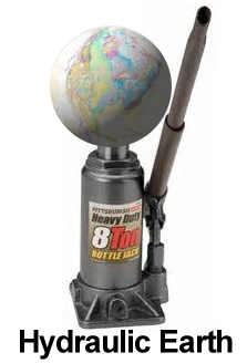
Flood Basalts - Hydraulic Earth
Mineral Belts
Pegmatites the Home of Gemstones
Where to Find Geodes
Mega-Thundereggs!
Delamination
Sedimentary
H2O-Simply complicated
D-Bone
Petrified Wood
Garnets
Jade
Picasso Marble
Impact
Impact Craters
Impact Cratering Process
Utah's Western Neighbor, Australia!
What is in the area you are visiting? Here are a few quick tips:
Did you know garnets are magnetic? Ants can share a wealth of information.
 Julie Powell and Sugar McDonald with magnets on rods, examining a Utah ant hill.
TIPS For Novices:
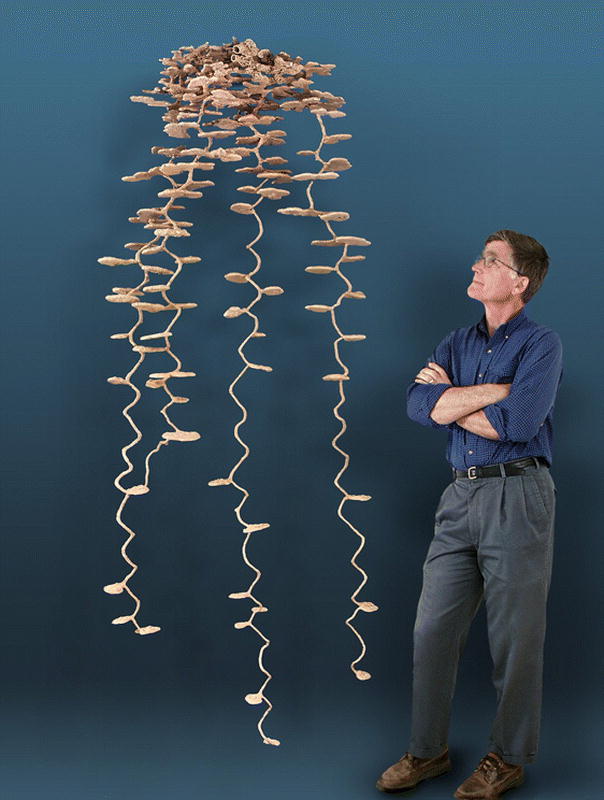
Tip #1. Check Ant hills! If there are crystals in the area you will usually find tiny bits on top of their hills. Quartz, Garnet, Peridot, . . .
Tip #2. Check stream beds! Bits of whatever is in the upstream watershed will be there. Follow the gold, petrified wood, or whatever upstream to it's source.
EXAMPLE: If you were south of Sacramento several hundred years ago, before all those people got in the way, in a dry season, imagine how easy it would have been to find where particular rocks were coming from.
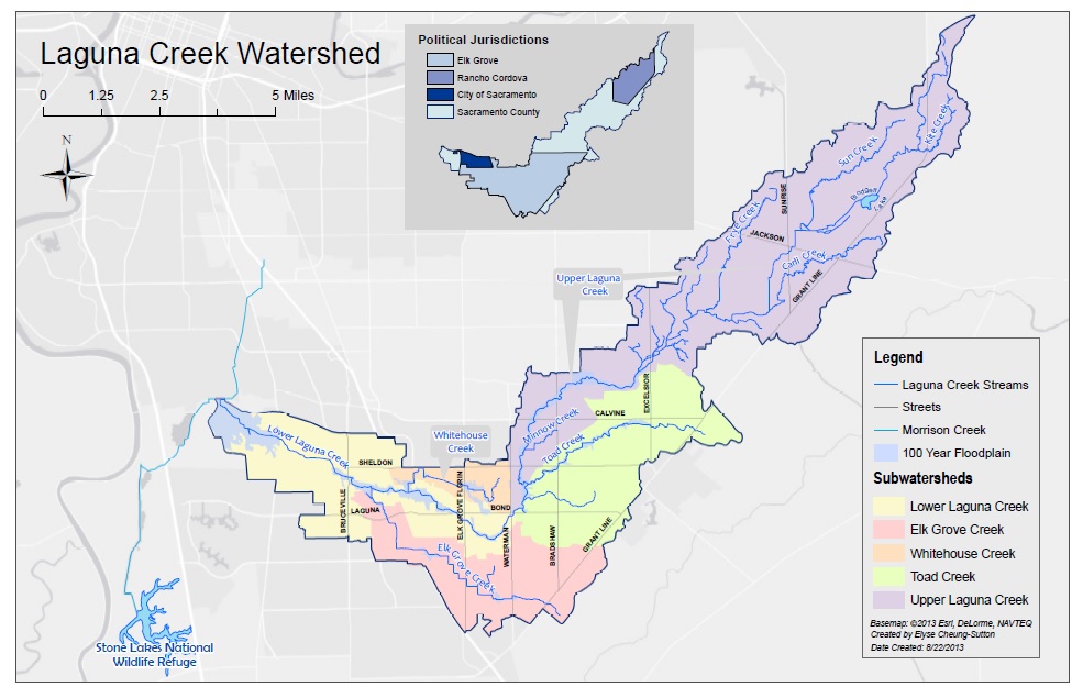
Laguna Creek Watershed - south of Sacramento California
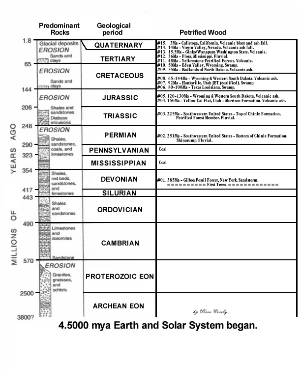
Tip #3. Knowing Where and When in Time to look is a great Luck Enhancer.
John McPhee wrote an interesting and informative series of books entitled:
Basin and Range, In Suspect Terrain, Rising From the Plains, Assembling California, and Crossing the Craton.
They have been compiled into a single and more complete book:
“Annals of the Former World.” A Great Read!
In short, Our world was formed by continents slamming into one another building mountains of basalt, andesite and granite; breaking apart in new sections, pinching sections between new collisions, and growing by scooping up islands as the continent sailed westward.
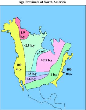
Throughout time we have been constantly bombarded by meteors, asteroids, comets, and even another planet which broke off our moon. Except for that collision, the others have added zones and ever higher layers of exotic materials.
Mountains have worn away, their debris filling valleys as new mountains formed, rivers, lakes, and oceans coming and going leaving tumbled stones and layers of sand, mud,limestone and dolomite.
The Times they are a changing!
A mere 144 million years ago there was a sea where the Mighty Rocky Mountains now stand.
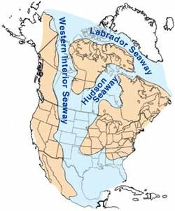
Information gathered by thousands of geologists over hundreds of years are available to be downloaded from your State Geology Organization and at:
USGS.GOV
ngmdb.usgs.gov/ngmdb/ngmdb_home.html
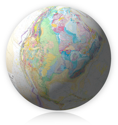
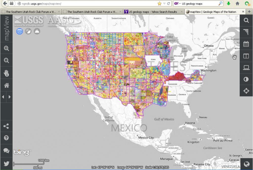
USAMapViewAvailable-1.jpg
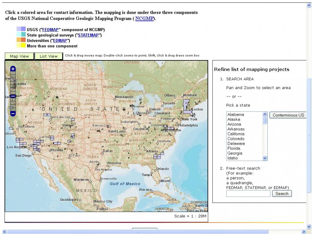
A closer examination reveals that many areas are still incomplete.
At present (2013-14)New mapping is continuing at the following locations : ngmdb.usgs.gov/MapProgress/MIP_home.html
New-Mapping.jpg
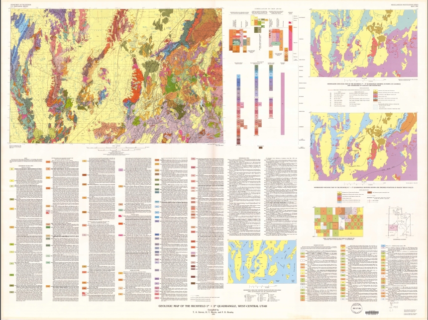
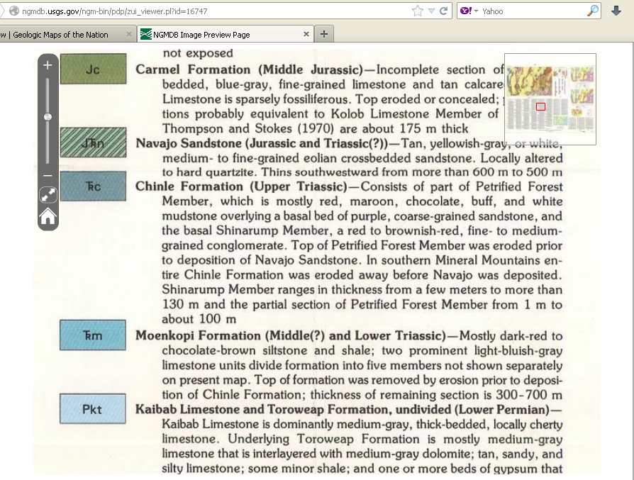
Most maps show geologic information in unique colors printed over topographic maps with side charts explaining what the colors mean. Often there are additional section maps - A-A, B-B etc. Included, sometimes with detailed descriptions of each layer. The following is from Map #I-1901 Richfield Utah Quad:
1-USGS-RichfieldQuad.JPG
1GeologyUtahChinleRichfield-2.JPG
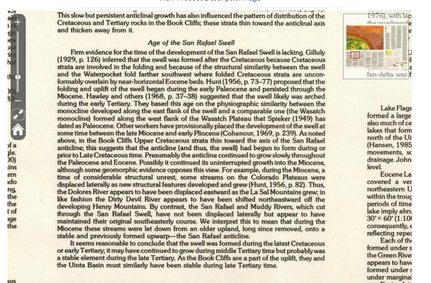
Note from another Utah map:
1GeologyAgeSanRafaelSwell-1.JPG
Centuries of excellent information!
MISSION: rather than give locations, Teach how to find locations.
With a little understanding on how our country was built and how to read Geology maps our hounding excursions can become more interesting and productive.
Here is a handy directory of LINKS to sections of specific interest:
Share your knowledge.
Books on Geology
Rock Stars - Brilliant Discovery's.
Identifying Rocks
Field Geologists
The Dying Times
Igneous
Diatremes
Hotspot Theory
Key to Finding Gemstones in Granite and Rhyolite
Flood Basalts - Hydraulic Earth
Mineral Belts
Pegmatites the Home of Gemstones
Where to Find Geodes
Mega-Thundereggs!
Delamination
Sedimentary
H2O-Simply complicated
D-Bone
Petrified Wood
Metamorphic
Garnets
Jade
Picasso Marble
Impact
Impact Craters
Impact Cratering Process
Utah's Western Neighbor, Australia!
What is in the area you are visiting? Here are a few quick tips:
Did you know garnets are magnetic? Ants can share a wealth of information.


TIPS For Novices:
Tip #1. Check Ant hills! If there are crystals in the area you will usually find tiny bits on top of their hills. Quartz, Garnet, Peridot, . . .
Tip #2. Check stream beds! Bits of whatever is in the upstream watershed will be there. Follow the gold, petrified wood, or whatever upstream to it's source.
EXAMPLE: If you were south of Sacramento several hundred years ago, before all those people got in the way, in a dry season, imagine how easy it would have been to find where particular rocks were coming from.

Laguna Creek Watershed - south of Sacramento California
Tip #3. Knowing Where and When in Time to look is a great Luck Enhancer.

John McPhee wrote an interesting and informative series of books entitled:
Basin and Range, In Suspect Terrain, Rising From the Plains, Assembling California, and Crossing the Craton.
They have been compiled into a single and more complete book:
“Annals of the Former World.” A Great Read!
In short, Our world was formed by continents slamming into one another building mountains of basalt, andesite and granite; breaking apart in new sections, pinching sections between new collisions, and growing by scooping up islands as the continent sailed westward.

Throughout time we have been constantly bombarded by meteors, asteroids, comets, and even another planet which broke off our moon. Except for that collision, the others have added zones and ever higher layers of exotic materials.
Mountains have worn away, their debris filling valleys as new mountains formed, rivers, lakes, and oceans coming and going leaving tumbled stones and layers of sand, mud,limestone and dolomite.
The Times they are a changing!
A mere 144 million years ago there was a sea where the Mighty Rocky Mountains now stand.

Information gathered by thousands of geologists over hundreds of years are available to be downloaded from your State Geology Organization and at:
USGS.GOV
ngmdb.usgs.gov/ngmdb/ngmdb_home.html


USAMapViewAvailable-1.jpg
A closer examination reveals that many areas are still incomplete.
At present (2013-14)New mapping is continuing at the following locations : ngmdb.usgs.gov/MapProgress/MIP_home.html

New-Mapping.jpg
Most maps show geologic information in unique colors printed over topographic maps with side charts explaining what the colors mean. Often there are additional section maps - A-A, B-B etc. Included, sometimes with detailed descriptions of each layer. The following is from Map #I-1901 Richfield Utah Quad:

1-USGS-RichfieldQuad.JPG

1GeologyUtahChinleRichfield-2.JPG
Note from another Utah map:

1GeologyAgeSanRafaelSwell-1.JPG
Centuries of excellent information!


